Filter
Filter
Tae Chosŏn Chido (v. 1875)


Tae Chosŏn Chido (v. 1875)
| Author | anonymus |
|---|---|
| Publisher | Reliefs Editions |
| ISBN | 9782380360875 |
| Idea Code | 250274 |
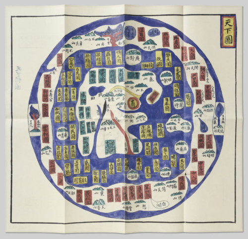
Created by an anonymous geographer around 1875, this map of the Chosŏn Empire reflects the ch’onhado projection—a Korean cartographic style meaning 'map of the world under the heavens,' linked to Buddhist cosmography. Developed in the 17th century, ch’onhado maps remained popular until the 19th century. They are circular, symbolising a flat earth, and have a Sino-centric perspective. The Tae Chosŏn Chido (Great Map of Chosŏn) shows China at the centre as a red circle with a yellow interior, Korea (Chosŏn) as a yellow-bordered rectangle with a red interior, and Japan in a yellow rectangle to the east. Surrounding rings of land and sea depict real and mythical places, drawn mainly from classical Chinese literature. These maps, unique to Korea, were usually the opening pages of atlases, offering a world view before more detailed maps of individual regions.
| 1 , ills colour, 19 x 35 cm, map, French/English |
Reliefs Editions

